


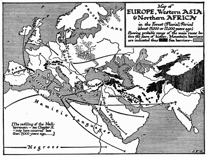
 Map of Europe, Asia, Africa 15,000 Years Ago
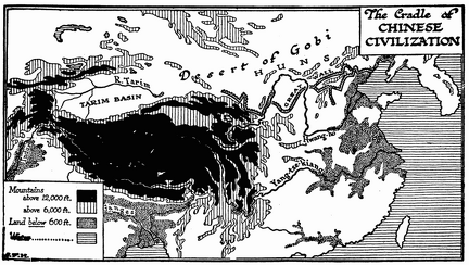 The Cradle of Chinese Civilization (Map)
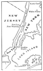 Map Illustrating the Battle of Long Island
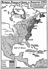 Britain, France, and Spain in America, 1750
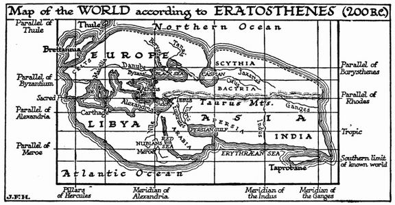 The World According to Eratosthenes, 200 B.C.
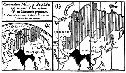 Comparative Maps of Asia under Different Projections
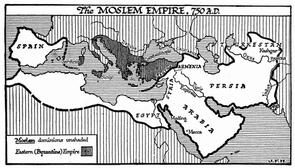 The Moslem Empire
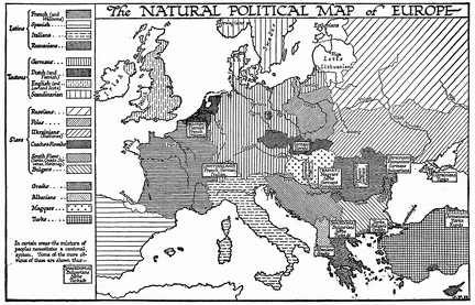 The Natural Political Map of Europe
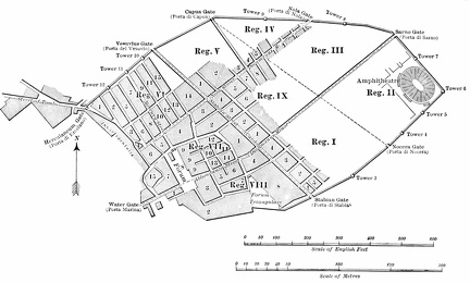 Outline plan of Pompeii
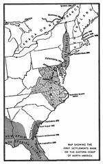 Map showing the first settlements made on the Eastern coast of North America
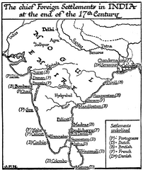 Chief Foreign Settlements in India, 17th Century
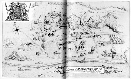 Drawing of Jamestown
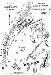 Battle of Palo Alto 8th. May 1846
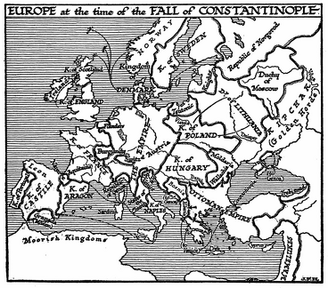 Europe at the Fall of Constantinople
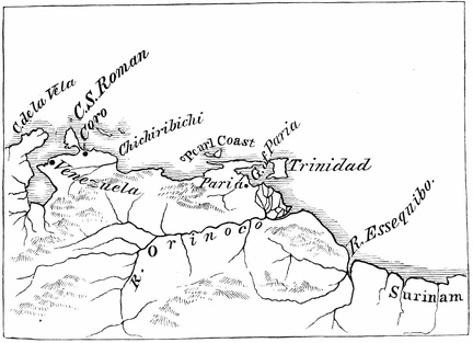 Ojeda's first voyage
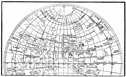 North America from the globe of Johann Schöner
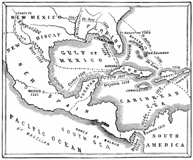 Routes of the discoverers
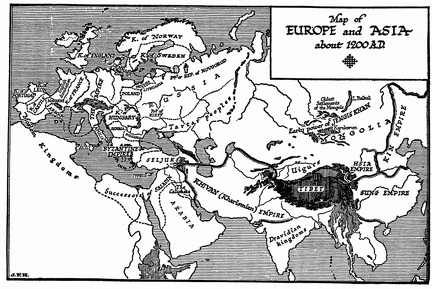 Europe and Asia, 1200
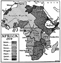 Africa, 1914
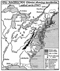 American Colonies, 1760
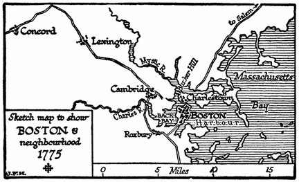 Boston in 1775
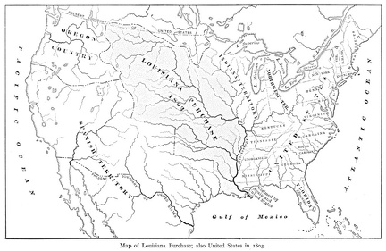 Map of Louisiana Purchase
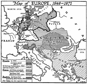 Map of Europe, 1848-1871
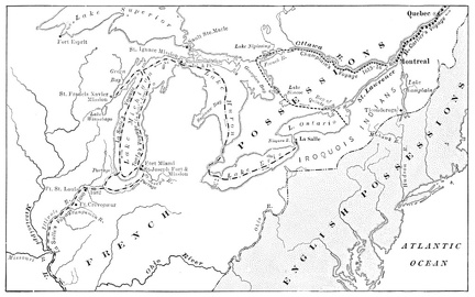 Map Showing Routes of Cartier, Champlain, and La Salle
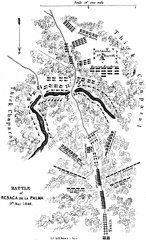 Battle of Resaca de la Palma 9th May 1846
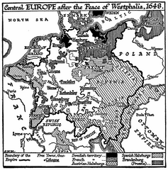 Central Europe, 1648
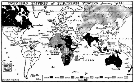 Overseas Empires of European Powers, 1914
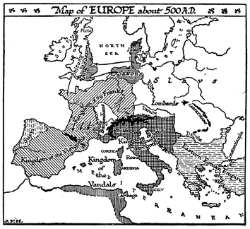 Europe, 500 A.D.
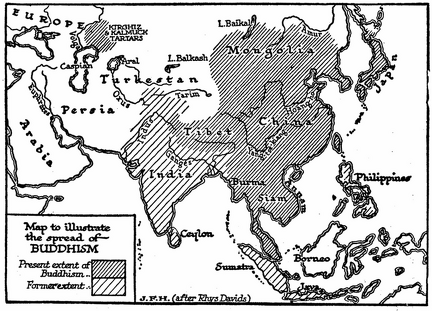 The Spread of Buddhism
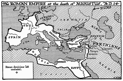 Roman Empire at Death of Augustus
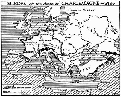 Europe at the Death of Charlemagne
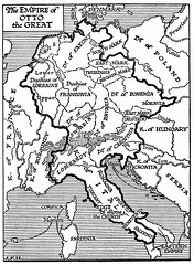 Empire of Otto the Great
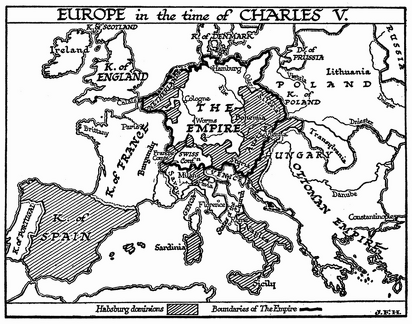 Europe in the Time of Charles V
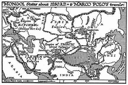 Travels of Marco Polo
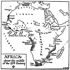 Africa in the Middle of 19th Century
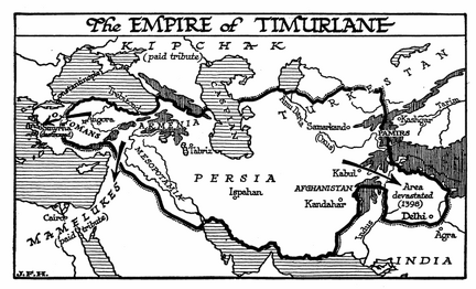 Empire of Timurlane
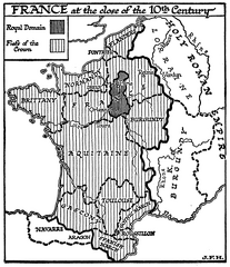 France at the Close of the 10th Century
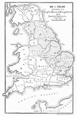 Map of England showing the Anglo-Saxon Kingdoms and Danish Districts
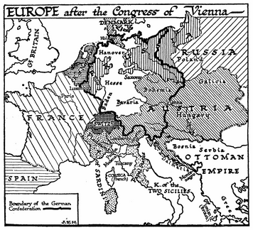 Europe after the Congress of Vienna
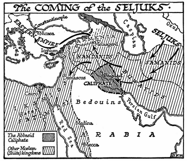 The Coming of the Seljuks
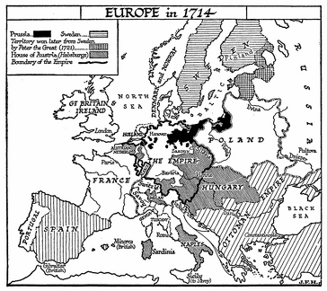 Europe in 1714
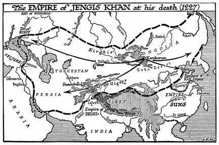 Empire of Jengis Khan, 1227
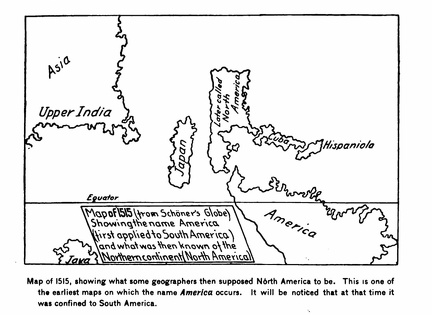 Map of 1515
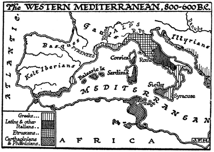 The Western Mediterranean, 800-600 B.C.
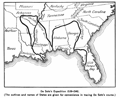 De Soto's Expedition 1539-1542
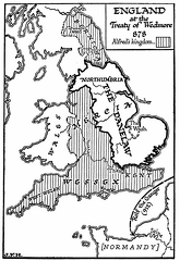 England, 878 A.D
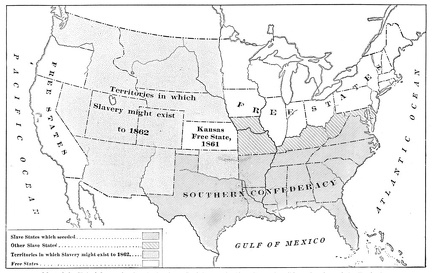 Map of the United States showing the Southern Confederacy
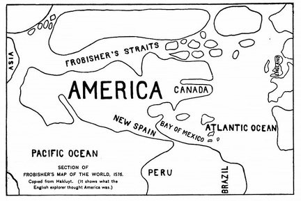 Section of Frobisher's Map of the World
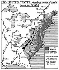 The United States in 1790
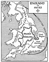 England, 640 A.D.
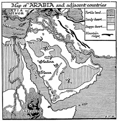 Arabia and Adjacent Countries
 Map of Europe, 500 A.D.
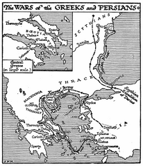 Wars of the Greeks and Persians (Map)
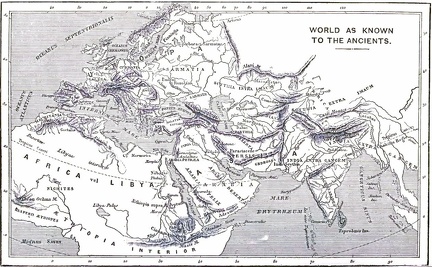 World as known to the Ancients
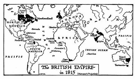 The British Empire in 1815
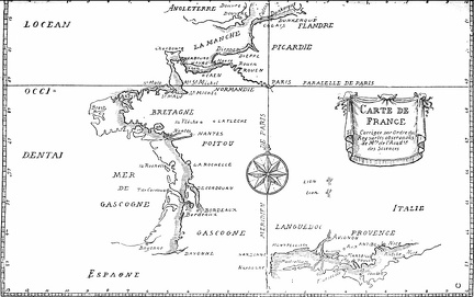 Map of France, corrected by order of the king
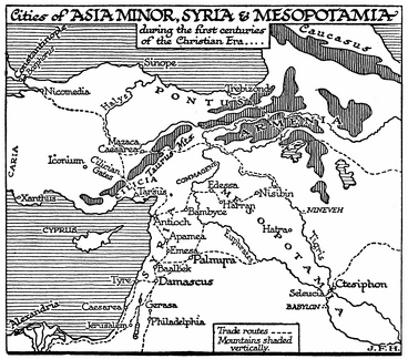 Asia Minor, Syria, and Mesopotamia
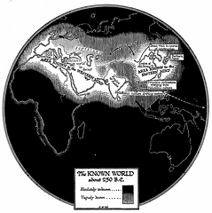 The Known World, about 250 B.C
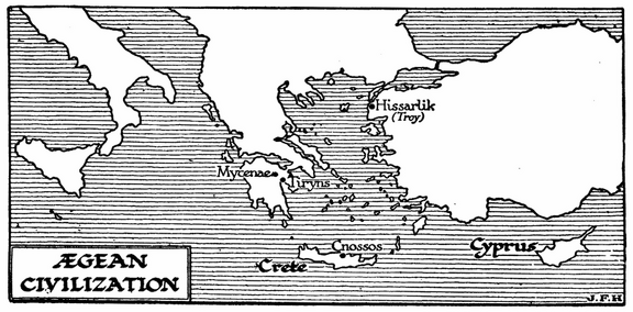 Ægean Civilization (Map)
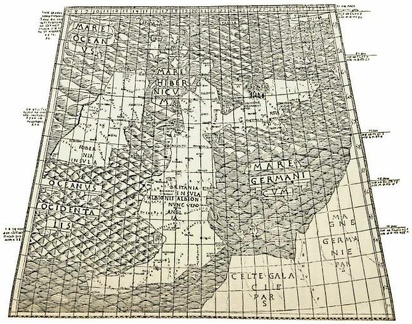 The First printed map of England