9/124

 Download Photo
)
)
)
)
)


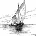
Table Bay is open to the force of north and northwest winds. Before the bay could protect ships from the frequent storms blowing from these directions a series of breakwaters had to be built, in the lee of which ships could anchor.
- Author
- Ships of the seven seas
By Hawthorne Daniel
Contributor: Franklin D Roosevelt
Published 1925
Available from gutenberg.org or archive.org - Posted on
- Saturday 10 February 2024
- Dimensions
- 1000*706
- Tags
- Albums
- Technology / Transport / Water
- Visits
- 225
- Downloads
- 12